The Post Grid
UDSM: Coming up with an umbrella challenge
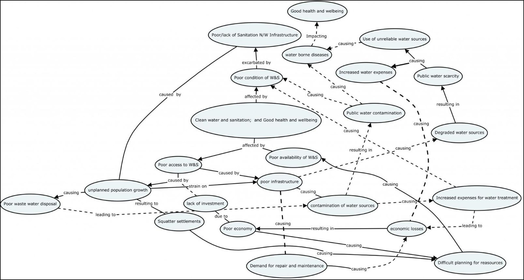
The motivation behind the decision for the two umbrella challenges for two MCL campaigns conducted...
SUA: Geospatial empowerment with MCL training
At Sokoine University of Agriculture (SUA), students prepared for the Multi-Competence Learning (MCL) Challenge with...


Resilience Academy: Classifying Sentinel 2 images in SNAP
Classify multispectral satellite images available in different platforms and download and manage the data sets...
Resilience Academy: Basic image processing methods with SNAP
Key steps of managing the data using the Sentinel Application Platform (SNAP) this includes installation...
Resilience Academy: Multispectral satellite images in environmental remote sensing
Key concepts of environmental remote sensing and practical understanding of the importance of Earth observation...

Community Urban Risk Mapping
On the basis of the practical lessons learned from Dar Ramani Huria this online course...