- Climate risk management
- Community mapping
- Data collection
- Events
UTU Master’s students visiting Sitowise

 News
News
A group of master’s students and a few members of staff from the University of Turku Geography dep
REGISTER NOW: June 5th – University partnerships driving socially innovative digital transformations

Webinar series 23.5.2024 – Geospatial Data Quality
 Events
Time: 23.5.2024 @9-10am (EEST) Topic: Geospatial Data Quality Meeting recording: Added soon!
TeamUp: 29 May – research and education cooperation opportunities with Tanzanian universities

UDSM: Coming up with an umbrella challenge
 Space-time systems skills
The motivation behind the decision for the two umbrella challenges for two MCL campaigns conducted i

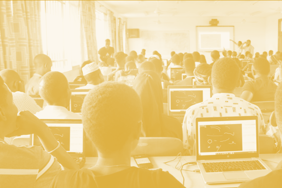
SUA: Geospatial empowerment with MCL training
Geospatial data and technology, Sokoine University of Agriculture
At Sokoine University of Agriculture (SUA), students prepared for the Multi-Competence Learning (MCL
Visit to Tanzania highlights the results of university cooperation – long-standing cooperation to be expanded

Resilience Academy: Classifying Sentinel 2 images in SNAP
 Remote sensing
Classify multispectral satellite images available in different platforms and download and manage the
Resilience Academy: Basic image processing methods with SNAP
Remote sensing
Key steps of managing the data using the Sentinel Application Platform (SNAP) this includes installa
Resilience Academy: Multispectral satellite images in environmental remote sensing
Remote sensing
Key concepts of environmental remote sensing and practical understanding of the importance of Earth
Community Urban Risk Mapping
 Community mapping
On the basis of the practical lessons learned from Dar Ramani Huria this online course has been esta
Resilience Academy: Geospatial data quality
Learn the principles, hands-on skills and good practices of assessing geospatial data quality, using geospatial data of different origin and...
Resilience Academy: Metadata
Learn principles and practical skills to use metadata standards for good quality geospatial data management. After completing the module, you...
Resilience Academy: Data sharing in Climate Risk Database
Learn principles of Spatial Data Infrastructures (SDIs) and practical skills in using SDIs and sharing your own data via Climate...
DIDAIhub: Geometries of geospatial data and basic statistics
Understand the basics of geometric and statistical properties and nature of geospatial data. Learn the skills to operate common analysis...
DIDAIhub: Principles of Open Data
Learn to define the concept of open data, and how to discover and use it as a research resource. Learn...
DIDAIhub: Geospatial data management in postgres/postgis databases
This mini-MOOC focuses on competencies in adding, organizing, querying, retrieving, and combining data, and assessing data consistency with the help...
DIDAIhub: Processing large raster images in GDAL
This mini-MOOC provides an overview of different phases of the data analysis pipeline using Python and its data analysis ecosystem...
DIDAIhub: Getting started with QGIS
QGIS is one of the most used desktop software for geospatial data management, analysis and visualisation. This entity provides the...