- Climate risk management
- Community mapping
- Data collection
- Events
Shaping Together in Finland – Sharing the Shape2Gether Experiences in Turku

 News
News
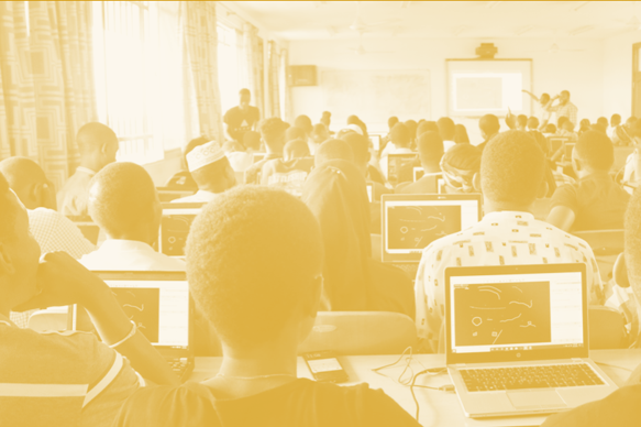
The Shape2gether -project is about shaping innovations in education for sustainable development: con


Shaping together in Germany – Designing games in the Ruhr area
 News
News
If you wish to explore the previous parts of this retrospective three-part blog series, you can find
Shaping Together in Malta – Exploring sustainability in the small Mediterranean nation
 News
News
If you wish to explore the first part of this retrospective three-part blog series, you can find the
Shaping Together in Norway – Learning about geosciences in sunny Tautra and Trondheim
 News
News
Blog series and project introduction Join us for our retrospective three-part blog series as geograp

DIDAIhub: Introduction to AI
 IT skills
Introduction to AI offers a comprehensive journey into the world of AI, starting from its foundation
DIDAIhub: Cloud Computing
IT skills
This course aims to enhance participants’ competencies in understanding cloud computing fundam
DIDAIhub: Ecosystem services
 Climate risk management
By the end of this mini MOOC, student will understand the concept, value, and social and environment
DIDAIhub: Sustainable development
Climate risk management
The student is able to comprehend information about sustainable development and has the ability to
DIDAIhub: Basic research information of climate change
Climate risk management
This Mini-MOOC is relevant information for communicating with local and regional planners of civil
DIDAIhub: Getting started with QGIS
QGIS is one of the most used desktop software for geospatial data management, analysis and visualisation. This entity provides the...
Resilience Academy: Geospatial data quality
Learn the principles, hands-on skills and good practices of assessing geospatial data quality, using geospatial data of different origin and...
Resilience Academy: Metadata
Learn principles and practical skills to use metadata standards for good quality geospatial data management. After completing the module, you...
Resilience Academy: Data sharing in Climate Risk Database
Learn principles of Spatial Data Infrastructures (SDIs) and practical skills in using SDIs and sharing your own data via Climate...
DIDAIhub: Geometries of geospatial data and basic statistics
Understand the basics of geometric and statistical properties and nature of geospatial data. Learn the skills to operate common analysis...
DIDAIhub: Principles of Open Data
Learn to define the concept of open data, and how to discover and use it as a research resource. Learn...
DIDAIhub: Geospatial data management in postgres/postgis databases
This mini-MOOC focuses on competencies in adding, organizing, querying, retrieving, and combining data, and assessing data consistency with the help...
DIDAIhub: Processing large raster images in GDAL
This mini-MOOC provides an overview of different phases of the data analysis pipeline using Python and its data analysis ecosystem...