

Resilience Academy: Classifying Sentinel 2 images in SNAP
Classify multispectral satellite images available in different platforms and download and manage the data sets using different open-source tools. You
Resilience Academy: Classifying Sentinel 2 images in SNAP Read More »
Resilience Academy: Basic image processing methods with SNAP
Key steps of managing the data using the Sentinel Application Platform (SNAP) this includes installation of SNAP, use of different
Resilience Academy: Basic image processing methods with SNAP Read More »
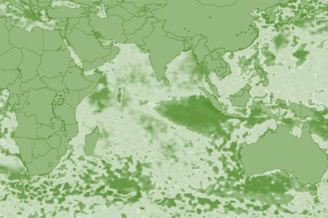
Resilience Academy: Multispectral satellite images in environmental remote sensing
Key concepts of environmental remote sensing and practical understanding of the importance of Earth observation in the identification, mapping, monitoring,
Resilience Academy: Multispectral satellite images in environmental remote sensing Read More »

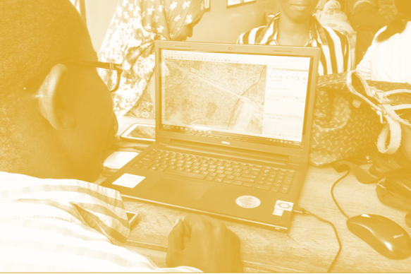
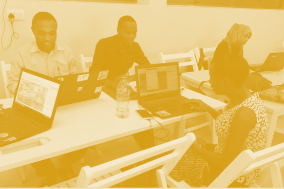
Community Urban Risk Mapping
On the basis of the practical lessons learned from Dar Ramani Huria this online course has been established. It includes
Community Urban Risk Mapping Read More »

Resilience Academy: Spatial analysis of PM data
Learn the principles of the analysis of geospatial data collected via participatory mapping.
Resilience Academy: Spatial analysis of PM data Read More »
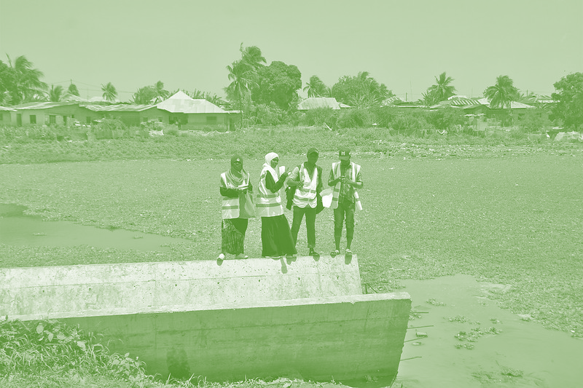
Resilience Academy: Participatory mapping process
You will learn the elements crucial for planning a participatory data collection campaign.
Resilience Academy: Participatory mapping process Read More »
Resilience Academy: Introduction to participatory mapping
You will learn the concepts and different participatory mapping tools and methods, which are applicable to local-level community participation, and
Resilience Academy: Introduction to participatory mapping Read More »
Resilience Academy: Urban climatology
Principles of regional and urban climates, the mechanics of UHI, and know how to observe urban weather phenomena. You will
Resilience Academy: Urban climatology Read More »
Resilience Academy: Humans as drivers of climate change
Principles of anthropogenic climate forcing, the current drivers and processes of climate warming and its regional variation, plus the concepts
Resilience Academy: Humans as drivers of climate change Read More »
Resilience Academy: Climate change
Principles of climate change, the major events in climate history and the key natural factors behind climatic variations.
Resilience Academy: Climate change Read More »
Resilience Academy: Climate system
Basics of the climate system and its key processes at the planetary level and in East-Africa. You will also understand
Resilience Academy: Climate system Read More »

DIDAIhub: Principles of Open Data
Learn to define the concept of open data, and how to discover and use it as a research resource. Learn
DIDAIhub: Principles of Open Data Read More »

DIDAIhub: Location data collection using mobile devices
This learning module introduces different location data collection methods using smartphone GPS. This is especially interesting and important since they
DIDAIhub: Location data collection using mobile devices Read More »

DIDAIhub: Geometries of geospatial data and basic statistics
Understand the basics of geometric and statistical properties and nature of geospatial data. Learn the skills to operate common analysis
DIDAIhub: Geometries of geospatial data and basic statistics Read More »
DIDAIhub: Story mapping
You can build a story map rich with geomedia that reflects relevant aspects of an area (history, natural/cultural processes, sustainability
DIDAIhub: Story mapping Read More »
DIDAIhub: Visualization of geospatial data and map making
Create and use maps and visualize geospatial data for dissemination of your work. You are able to evaluate the quality
DIDAIhub: Visualization of geospatial data and map making Read More »

DIDAIhub: Working with interactive webmaps
With this learning module, you are able to critically think about the designing and planning of interactive web maps. You
DIDAIhub: Working with interactive webmaps Read More »
Resilience Academy: Dynamic flood modelling in 2 dimensions
Learn how to establish a detailed 2-dimensional flood schematisation of a river section in Dar es Salaam within a Graphical
Resilience Academy: Dynamic flood modelling in 2 dimensions Read More »
Resilience Academy: From flood hazard to flood impact
Learn practical skills to turn a hazard map in a flood impact map within the already known QGIS interface. Consolidate
Resilience Academy: From flood hazard to flood impact Read More »
Resilience Academy: Flood zone mapping
Learn hands-on how a digital terrain model and a vector dataset of main streams can be used to make flood
Resilience Academy: Flood zone mapping Read More »
Resilience Academy: Principles of flood mapping strategies
Understand the concepts of flood hazard mapping, flood exposure mapping, flood vulnerability mapping and flood impact. Furthermore, an overview of
Resilience Academy: Principles of flood mapping strategies Read More »
Resilience Academy: Geospatial Data Visualisation Challenge
Learn to apply data visualisation skills via a Data Visualisation Challenge, which is a real-world need-based competition, targeted to make
Resilience Academy: Geospatial Data Visualisation Challenge Read More »
Resilience Academy: Geovisualisation tools
Learn what geospatial datasets and open-source tools can be used to make geovisualisations and digital maps. Know how to use
Resilience Academy: Geovisualisation tools Read More »
Resilience Academy: Geovisualisation principles and examples
Learn the principles of geospatial data visualization and what elements form a good data visualization solution.
Resilience Academy: Geovisualisation principles and examples Read More »

Resilience Academy: Data sharing in Climate Risk Database
Learn principles of Spatial Data Infrastructures (SDIs) and practical skills in using SDIs and sharing your own data via Climate
Resilience Academy: Data sharing in Climate Risk Database Read More »
Resilience Academy: Metadata
Learn principles and practical skills to use metadata standards for good quality geospatial data management. After completing the module, you
Resilience Academy: Metadata Read More »
Resilience Academy: Geospatial data quality
Learn the principles, hands-on skills and good practices of assessing geospatial data quality, using geospatial data of different origin and
Resilience Academy: Geospatial data quality Read More »

Resilience Academy: Geonode customisation and Source Code revision control
Build an understanding of administering Geonode on the front end of the application. You should be able to interact with
Resilience Academy: Geonode customisation and Source Code revision control Read More »
Resilience Academy: Using Geonode system
Acquire knowledge on editing basic account information in Geonode platform, work with various document types such as layers and maps.
Resilience Academy: Using Geonode system Read More »